新闻中心 新闻中心
产品分类
联系方式
站内搜索 荣誉资质
友情链接
|
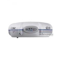
详细信息 Product Name: Topographic Surveying Static Chc X20+ Gnss Rtk Survey GPS Model NO.: X20+ Accuracy: 5mm+1ppm, 10mm + 2ppm Weight: 3.6 Kg Water and Dust Proof: IP67 Internal Memory: 4G Trademark: chc Transport Package: Standard Export Carton Specification: 20x30x20 Origin: China HS Code: 9031809090 Product Description Key advantages:*372 channels multi-constellation receiver*Single-button operation for easy use*Compact, rugged, small and light-weightStandard Configuration and application:CHC X20+GNSS characteristicsChannels12 channels, GPS L1 C/A code, L1 full carrier, SBASmainboardHemisfere (ARM)satellite signalsGPSPerformance specificationsPost Processing StaticHorizontal5 mm + 1 ppm RMSVertical10 mm + 2 ppm RMSbaseline Length< 10 kmPhysicalSize (HxD)65 x 180 mm (2.6 x 7.0 in)Weight0.8 Kg with battery (28 oz)Operating temperature-30 °C to +60 °C (22 °F to 140 °F)Storage temperature-40 °C to +70°C (40 °F to 158 °F)Humidity100% condensationWaterproof and dustproofIP67 protected from temporary immersion to depth of 1 meter, floatsShocksurvives a 2meter drop on to concreteElectricalPower consumption1.8WLi-ion battery capacity2200mAhBattery lifeup to 8 hoursExternal power input9-18 VDCCommunicationsRS232 serial portyeshigh speed USByesProtocolsRINEX and HCN outputs for GNSS raw datayesData Storageinternal memory4Gas a USB external hard driveyesProducts:
|